


Having a basic understanding of what your fishing electronics can do will undoubtedly make you a better angler, and ultimately, you will catch more fish.
Mastering Musky Fishing on Lake Wahbagoon
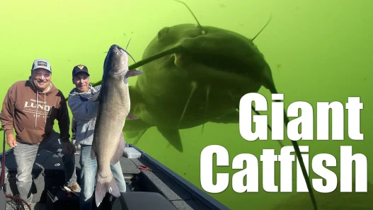
How a fully-rigged tiller boat and modern sonar tools unlock Sunset Country’s dirty-water giants
Sunrise, Hot Water, and Jumping Muskies
“Got him—big one!” The day begins with explosive surface strikes on Ontario’s Lake Wahbagoon, and the water is as warm as the bite. Jeff sets the hook on a spotted leopard of a musky that cartwheels beside the boat before sliding gracefully back into the stained depths. We’re in Sunset Country, a region where multi-species action is legendary, but today’s mission is musky—and, more specifically, how cutting-edge electronics make finding these apex predators faster, safer, and more efficient.
Why All Those Screens in a 16-Foot Tiller?
At first glance the cockpit looks like NASA on a coffee break: four networked Humminbird units—Apex 16, Solix 12 (bow), plus dual Solix 12s at the console—feeding mapping, 2-D sonar, down imaging, side imaging, and MEGA Live forward-facing sonar to every seat onboard. Overkill? Maybe for some. For us, it’s a systematic approach:
| Position | Primary Use | Screens & Transducers | Key Benefit |
|---|---|---|---|
| Bow (casting) | MEGA Live & Side Imaging | Apex 16 (FF sonar) + Solix 12 (SI & GPS) | Real-time target tracking and precise cast angles |
| Console (tiller/trolling) | High-speed navigation & mapping | Dual Solix 12s | Safe running through unmarked hazards; AutoChart recording |
By networking every unit, the crew can pull up any transducer feed and any map layer on any screen. Whether back-trolling break-lines or pitching bucktails up front, nobody fishes blind.
Dirty-Water Mapping: Your Lifeline on Shield Lakes
Wahbagoon’s glacial tea color hides reefs until your skeg grinds them. A LakeMaster DX Ontario chip plus two Zero Lines cards (bow and stern) form the heart of the navigation plan. The chip provides HD contours where available; AutoChart Live fills in the blanks everywhere else:
- Record while you run. The stern Solix 12 logs depth data automatically whenever the big motor is down.
- Networked hack. The bow Apex is instructed to use the stern transducer while travelling so both units build the same map simultaneously—even when the trolling motor is stowed.
- Save your tracks. Each evening, Jeff locks in the day’s breadcrumb trail so the plotter never overwrites safe routes through boulder mines.
In just a week, the crew turns a blank expanse into a color-coded atlas of reefs, fingers, and hard-to-soft transitions.
Screen Real-Estate: A Tactical Layout for Casting
While working weed edges, the Apex 16 shows nothing but MEGA Live—full screen—because tiny icons hide critical tells like following fish or bait plumes. The adjacent Solix 12 runs a split view: GPS chart on top, side imaging below. Combined, they create a “what’s next” overlay:
- Side Imaging: Spots the weed line or rock pile 30 feet abeam.
- Forward-Facing: Reveals fish, rocks, or bait directly ahead, allowing anglers to cast before ever crossing the target.
This one-two punch quickly proves its worth when weedlines go cold and a mid-lake boulder complex lights up with muskies.
The Rock Pivot: Finding Boulders with Side Imaging
Shield-water muskies love broken, blocky rock—round boulders with dark crevices—not smooth granite slabs. Side imaging exposes those prime crevices in a single pass, guiding casts to sweet-spot “fingers” rising from 12 feet to 8 feet. Jeff’s second throw with a new bait torques into a thick, spotted fish: proof that sonar interpretation trumps blind loyalty to weeds.
Unsung Hero: 2-D Sonar at 40 mph
Forward-facing sonar can’t read when the hull is trimmed out, and side imaging blurs above 10 mph. Classic 2-D fills the gap. At wide-open throttle it shows bottom hardness, marks bait in rock spines, and—most critically—alarms when depth needles upward so the skipper can throttle down before fiberglass meets Canadian granite.
Track Management: Don’t Lose Your Breadcrumbs
Canadian lakes lack channel markers. A saved GPS track becomes your personal highway. The Solix memory eventually overwrites old data, so the crew religiously “Save Current Track” after every exploratory run. That precaution turns a day-one crawl into a day-three sprint and prevents midnight returns from becoming an orienteering nightmare.
AutoChart on the Fly: Building a Private Chart Library
Any time a rise blips the depth graph, the helm slows to idle loops. Three circles and AutoChart renders a high-def mini-reef—potentially a crown topping at three feet that could hold midday muskies or golden-hour walleyes. Year over year, those mosaic tiles stitch into a proprietary masterpiece unavailable on any retail chip.
Bonus Bites: Walleyes in the Musky Net
The electronics don’t discriminate. When a heavy “thunk” halts a glide bait, the crew swings a trophy walleye into the musky cradle—proof that detailed habitat intel benefits every species in Wahbagoon’s stained water.

